Footpath, Bridleway or Farm Track: What Each Route Is For
Learn how to distinguish a footpath, bridleway and farm track by their shape, surface and connections, and read the practical role of each route.
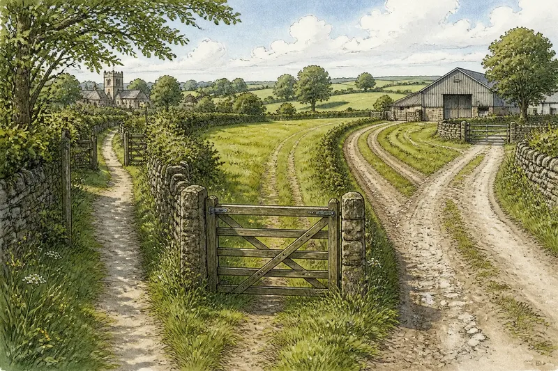
A footpath, bridleway or farm track can cross the same field, but the way each meets a gate, hedge or field entrance often reveals its working role. To distinguish a footpath, bridleway and farm track, look at how the route is shaped and what it connects—not just how wide or muddy it appears.
Routes change with weather, repairs and nearby farm work. A walking line may broaden around a wet hollow, while wheel marks can cross a public path on their way to a field. Read the route as a piece of landscape infrastructure: ask what movement its shape accommodates, and keep that physical reading separate from any legal claim about access.
Width and wear
A footpath often appears as a slim, continuous line of compacted earth, short grass or scattered stones. Its edges may be soft, and it may fade under crops or leaf litter. A wider patch alone does not change that reading: walkers may have spread out to avoid mud or paused near a gate.
A bridleway often leaves a corridor with room for a horse and rider, although hedges and gates can narrow it at particular points. Follow the route beyond the pinch point. A continuous passage with enough space at approaches and turns is more informative than one tight section.
A farm track often links gateways, yards, barns or field corners where equipment needs to enter. It may be broad and firm, or just a pair of wheel lines across grass. Look for a recurring working pattern: ruts leading into a field, a reinforced gateway or a widened turning place.
Width works best as a comparison across a stretch. Ask whether you see one walking line, a corridor that accommodates animals, or a working surface that connects field entrances. None of these patterns, by itself, establishes who is entitled to use the route.
Surface and upkeep
Footpaths often follow the ground, with local repairs such as stepping stones, a plank over a wet spot or a short gravel section near an entrance. A sudden change in surface may mark a practical fix rather than a different route type.
Bridleways can be grassy, earthy or stony. Hoof marks or churned edges may appear after wet weather, while a raised center or shallow ditch can help water drain. The useful clue is the pattern along the route, not whether it looks smooth or finished.
Farm tracks may show repairs suited to reaching a field: crushed stone in wheel lines, concrete just inside a gate, or patches where water has cut across the ground. Notice where the treatment starts and stops. A firm apron at one entrance may protect a busy threshold without describing the route beyond it.
Weather can disguise these patterns. Dry grass hides shallow ruts; rain makes depressions and drainage channels clearer. Leaves soften compacted ground, and frost can make mud look firm. Compare a longer stretch rather than drawing a conclusion from one day’s surface.
Connections and edges
A route’s connections can explain its practical role. Footpaths often link places reached on foot, such as a village edge, lane, footbridge or churchyard path. A narrow opening, stile or kissing gate may show how the line passes through a boundary.
Bridleways connect lanes and field paths in a way that can give riders room to continue. Entrances may be broad, and bends may leave space to turn, though a route can still pass through gates or wooded sections. Consider the sequence of entrances, not a single barrier.
Farm tracks tend to join working places: field gates, barns, yards and loading areas. A track that ends at a field gate may serve that field rather than connect onward to a village. A line that runs along a hedge may give access to a plot, while one crossing the field may serve a different purpose.
When a route meets a boundary, look for what lines up: do wheel marks lead through a gateway, does a narrow tread continue toward a lane, or does the route turn toward a farm entrance? These relationships help describe how the landscape is used. They do not settle the route’s formal designation or access rules.
When clues conflict?
When the clues disagree, record the separate patterns instead of forcing one name onto the whole stretch. A broad surface with a narrow walking tread, for instance, may reflect overlapping uses or a repair. Follow each visible line to its next junction, gate or boundary opening; note whether it continues, merges or turns toward a working entrance. If the physical clues still point in different directions, describe the route as mixed or unclear rather than treating one feature as decisive. For access decisions, consult the relevant local rights-of-way map or authority.
Can a footpath look like a farm track?
Yes. Repairs, drainage or heavy foot traffic can make a walking route broad or stony, and farm work nearby may leave marks across it. Compare the longer tread and its connections instead of relying on one patch.
Does a narrow route rule out horses?
No. A hedge, gate or local change in terrain can pinch a route that is otherwise passable. Look at the space on either side and how the route continues beyond the narrow point.
Why do wheel ruts appear on a footpath?
Vehicles may cross a route to reach nearby fields or use the ground around a gate. Ruts show vehicle movement at that spot, but do not establish the route’s intended role or access status.
What if the route changes halfway along?
A change may follow a shift in ground, drainage, boundary or maintenance. Mark where it happens, then check whether the route also meets a gate, bridge, lane or working entrance there.
A worked route reading
Say you reach a grassy line across a field. At the western gate, you see a firm strip; beyond it, two faint ruts angle toward a barn, while a narrow tread continues toward a village lane. Start by noting each line separately. Follow the wheel marks to the barn entrance and the tread toward the lane; at the split, check whether the lines remain distinct or merge. The resulting reading is that the field contains a walking connection and a separate-looking working access line. If they merge before either destination, record the shared section as mixed rather than assigning the whole route one function. This invented situation illustrates a way to describe visible clues, not a ruling on access.
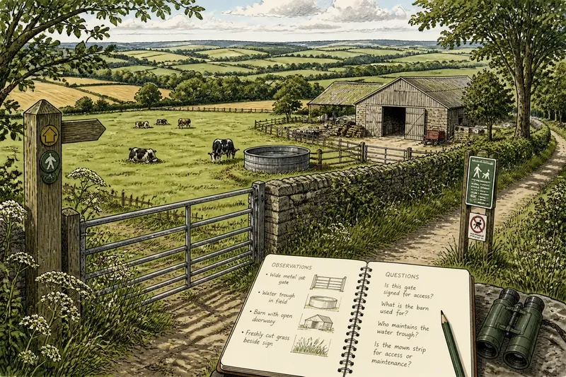
At a gate, bridge or surfaced entrance, compare the route just before and after the feature. A small notebook or phone photo can help you remember where the width or surface changes, especially when grass or leaves obscure the edges. Focus on observations you can point to: a tread, a gateway, a turn or a connection.
Reading the route
Seasonal change can make a route’s structure easier or harder to see. Summer grass may hide the edge of a narrow track; rain can reveal a firm center or shallow rut. Bare hedges may expose openings that foliage concealed. These shifts help explain physical use, but a landscape view alone cannot tell you the rules that apply.
To distinguish a footpath, bridleway and farm track, compare width, surface, upkeep and connections across the full route. If those clues remain mixed, describe what is visible and check a local rights-of-way map or ask the relevant authority before making an access decision. A careful description of the ground is useful even when a formal label remains uncertain.